What a Relief!
You have no doubt heard of the sporting expression ‘a game of two halves’. Well, it sounds as though Mrs Hastings’ Geography lesson with 4ML was a lesson of two halves, unequal in time but most certainly equal in both interest and genuine fascination.
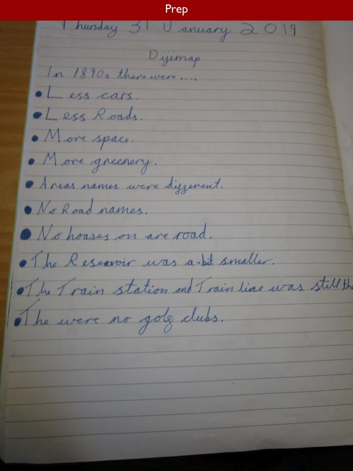
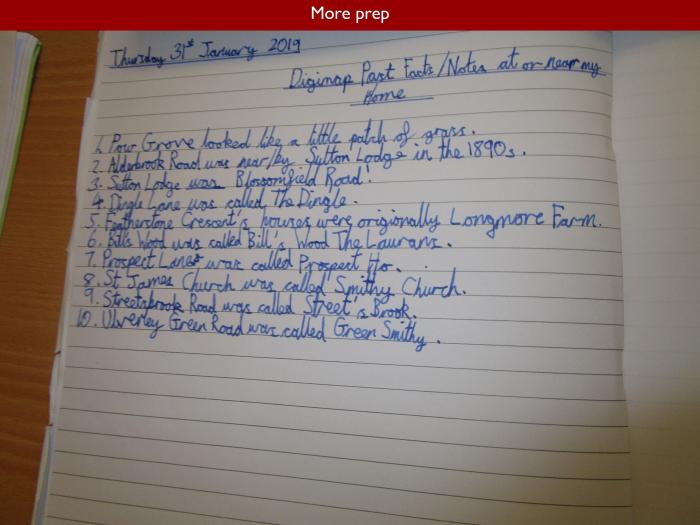
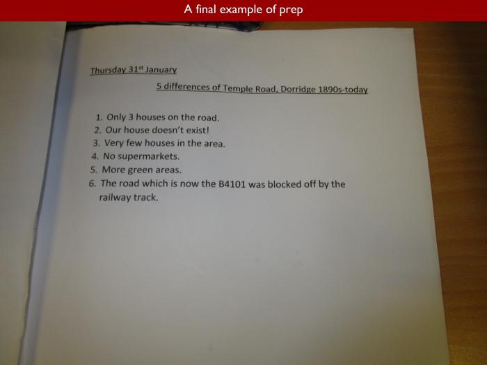
The children in Form 4 are studying mapping this half term and, for their prep, they were asked to explore one of the features of Digimap. Digimap is an internet-based service to which we subscribe as a school, and which enables children to explore interactively the Ordnance Survey maps of the United Kingdom. The marvel of it is that you can easily zoom in and out to change the scale of the map, depending on the lesson context, and you can accurately measure and compare distances between locations. You can also overlay features from OS maps dating back to the Nineteenth Century, and this is what Mrs Hastings asked 4ML to do for homework.
If I could time travel, I would like nothing better than to visit the place where I now live before it was a suburban road lined with houses and gardens. As it happens, I have lived in my present home not far from Eversfield for very many years and, when we first moved in, we often used to unearth pieces of clay pipe in the garden, relics of the cheap disposable smoking ware used by agricultural labourers when the land was just open fields.
Noah discovered that, although his house appeared to have been constructed on the earlier map, there were no others around it. Oliver found something similar. The farmhouse where he lives was a working building in the 1890s, and so were the barns surrounding it, which have now been converted into dwellings for humans rather than animals.
Nihaal noticed that Olton Reservoir appears on all the maps, although he believes it has become bigger over time. I am not sure that this is the case. The Reservoir, which is linked to the nearby canal, was built by French prisoners of war in 1799, and was actually made very slightly smaller many years later due to the construction of the railway line and the strengthening of the bridge over the Warwick Road. Dan, meanwhile, was perplexed to find that the area where he lives was referred to on the old maps as World’s End, and I have to say I share his bafflement because I can’t recall ever hearing anyone say that they live or originate from such a place. Happily, however, the world has never shown any sign of ending on the road between Eversfield and Dovehouse Parade, although one might speculate that it was formerly quite a desolate, sparsely populated area, with few features except the ancient oak trees which give their name to Broad Oaks Road.
Charlotta was interested to note that Olton Golf Course does not appear on the earliest map she studied. In fact, although Olton Golf Club has recently celebrated its 125th Anniversary, it did not move to its present location until 1903 and so would not appear on the 1890s map. Incidentally, Lily Moore, whose family built the original Eversfield in the 1880s and used it as their family home, was an early lady member there, and was runner up in the British Amateur Championship in 1910 at the age of only eighteen. These days, you can take a lovely walk alongside the golf course, behind the houses on Buryfield Road. I suspect that this path, which runs in various forms all the way from Lode Lane to Heaton Road, is an old field path, judging by the height and thickness of the hedgerow. Charlotta also noticed the proximity of Coldlands Wood, which appeared to be an extension of her back garden. This wonderful wood, where you can see native English bluebells in springtime, is one of the few remaining fragments of the ancient Forest of Arden.
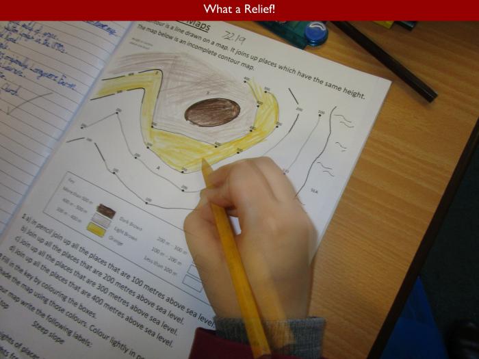
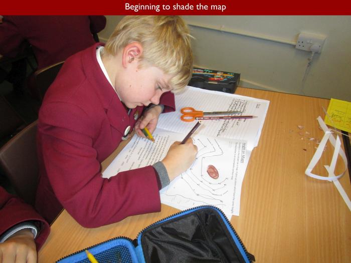
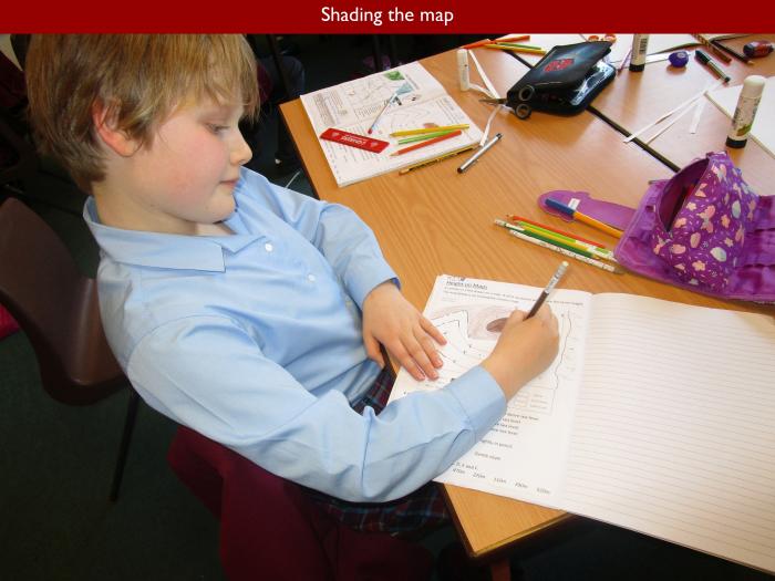
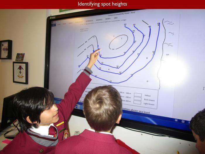
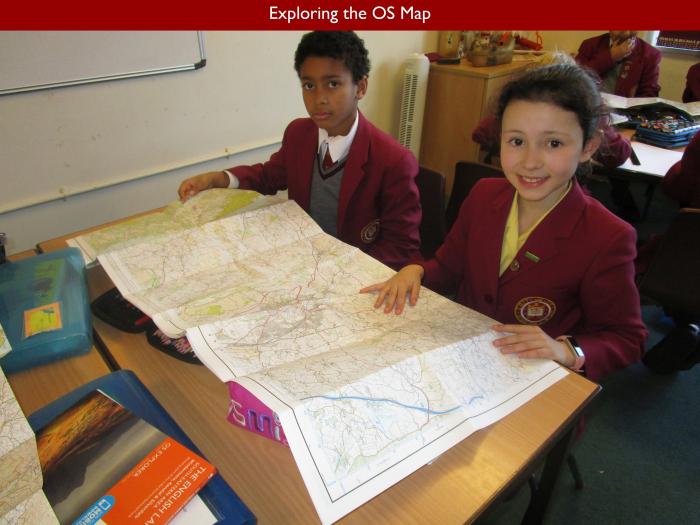
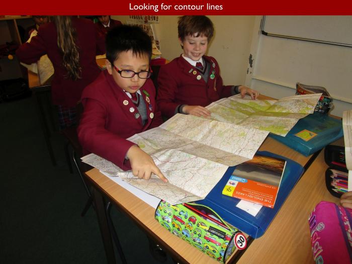
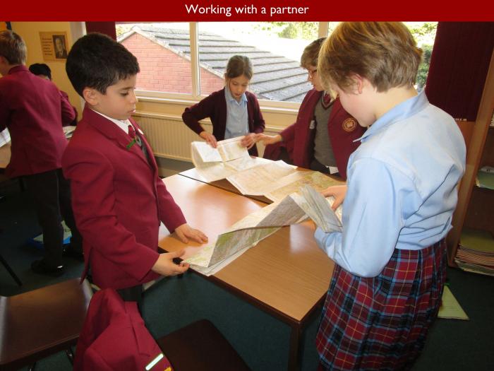
Discussion over, it was time to hand out the OS maps in class, and to have a look for contour lines. The children were quick to appreciate why these lines are so important on a map. Charlie knew immediately that they show where the hills are. Aliya very cleverly observed that the way the lines curve tells us about the shape of the hills, making them easy to recognise when we are in the field.
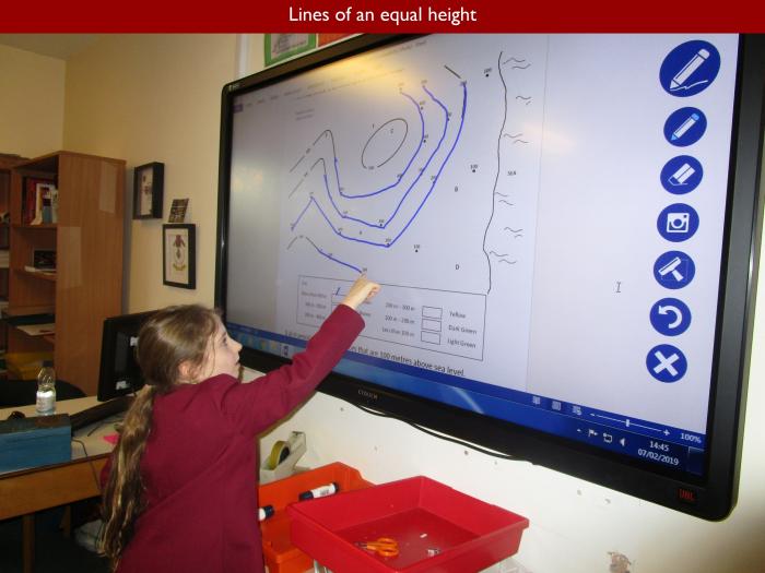
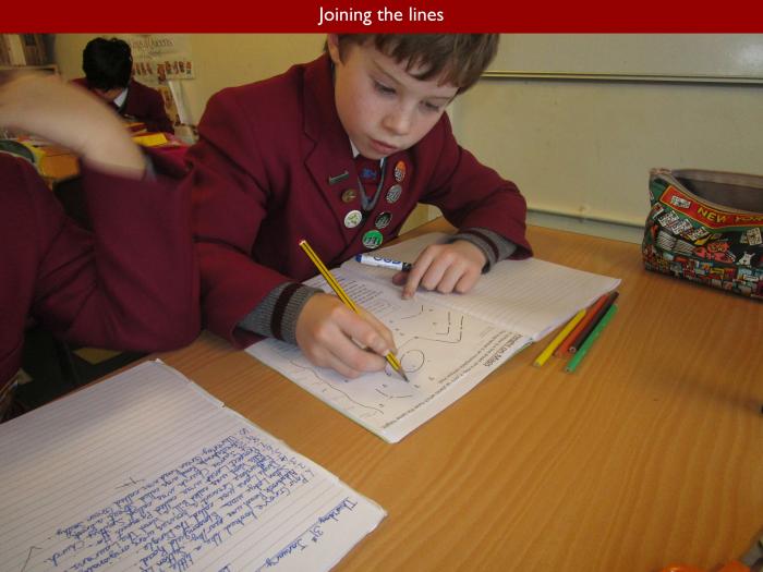
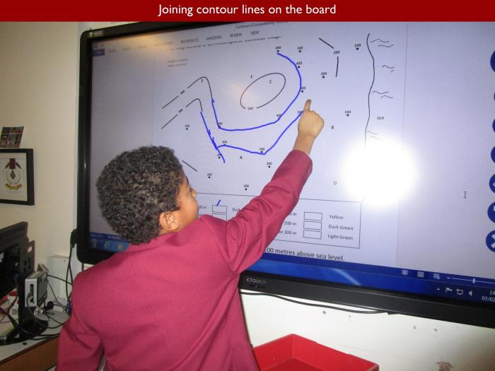
Contour lines join points on the map with the same elevation above sea level. Using the interactive whiteboard, members of the class had a go at joining the dots, so to speak, revealing the shape of the hills on the sample map they were using. Alice soon noticed that there was no regularity in the spacing between the lines. In fact, the closer together the lines on the map, the steeper the slope; something to which I always pay very close attention when planning a country walk.
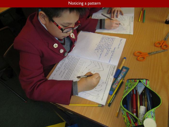
The children went on to shade the areas of relief on the map according to the accepted colour scheme. This enables us to see at a glance where the high ground is and, taking things a step further, to understand how the landscape works in terms of the shape of river valleys, and where the watersheds are located. In a future lesson, 4ML will go on to discover how their colour shading for relief is used universally on maps, which will help them to apply what they have studied at local level to their learning in national and international geography. Thus, in the space of a single hour, the children have travelled through both time and space, have learnt a lot, and hopefully will be inspired to explore the wonderful world of maps a great deal further.